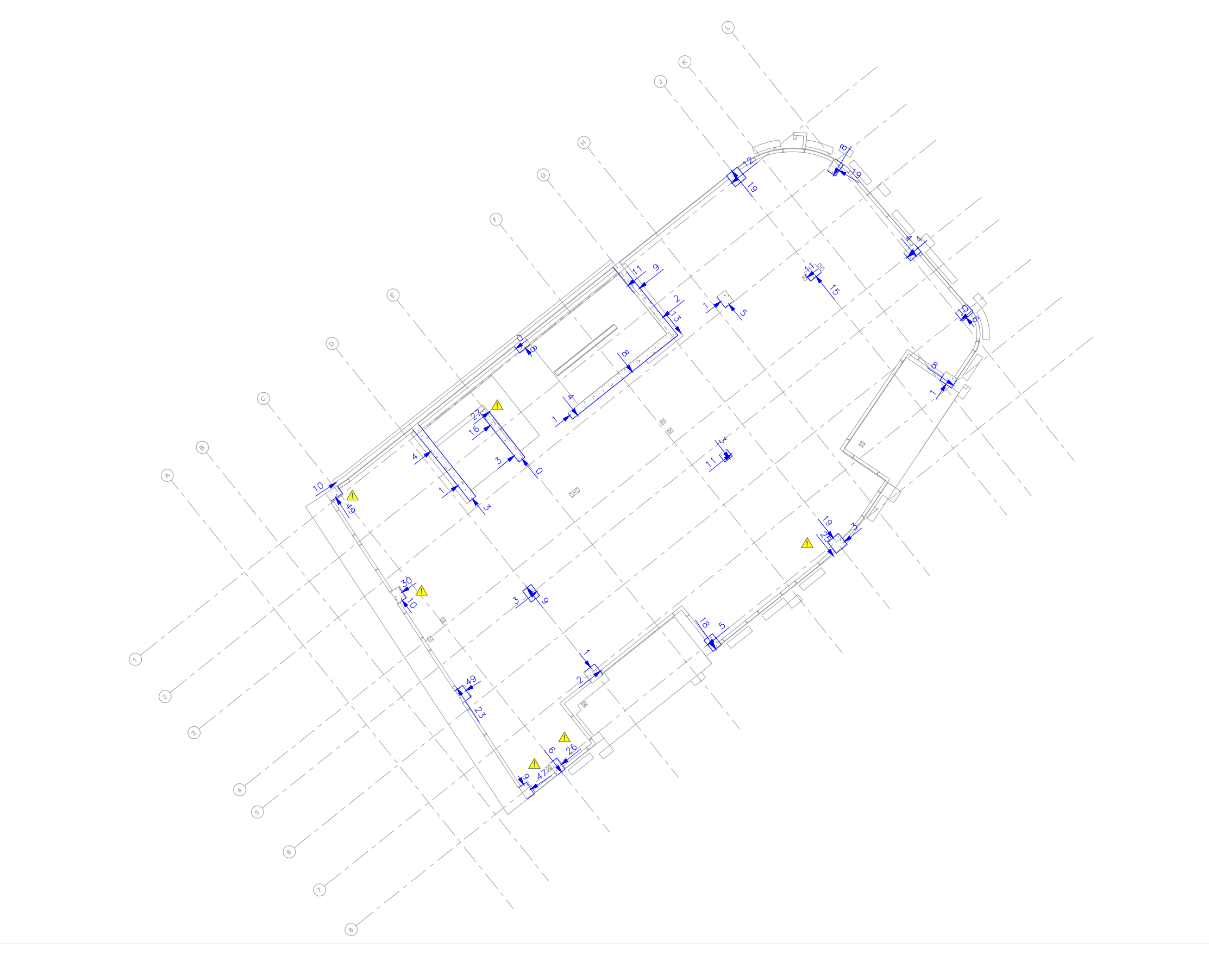
In the construction process, setting out is a crucial phase. To precisely place and mark out the location of planned structures, a surveyor or setting out engineer is required. This procedure is crucial because it ensures that the proposed elements appropriately reflect design plans while ensuring trade collaborations run smoothly. A few examples of setting out are marking columns and walls, piles, drainage SVPs, brickwork lines and corners, holding down bolts, grid lines, etc.
Starting with the precise coordination of digital site designs and the extraction of setting out data using proprietary software, we are eliminating human error.
Positioning data is physically translated on-site using precise robotic total stations and clearly visible markings are established. Internal quality control (QA) ensures that the setting out data does not deviate from the design and all markings are within tolerances.
MOVEMENT MONITORING
Movement monitoring surveys help recognise and respond promptly to the movement of buildings, earthworks, structures, as well as natural features. As insurance against third-party claims, movement monitoring surveys and reports are frequently required. It is critical that equipment has high accuracy and a good standard of practice is used.
The use of high angular precision total stations combined with the capability to act quickly results in a reliable, cost-effective movement monitoring service that alerts parties to any movement that may exceed specified trigger values. This is easily accomplished through the use of reports and graphs.
AS-BUILT AND VERIFICATION SURVEYS
As-built surveys confirm that the subcontractor has completed his job within the required tolerances as part of the quality control procedure. Frequently, principal contractors would ask for an independent survey before any subsequent trades start.
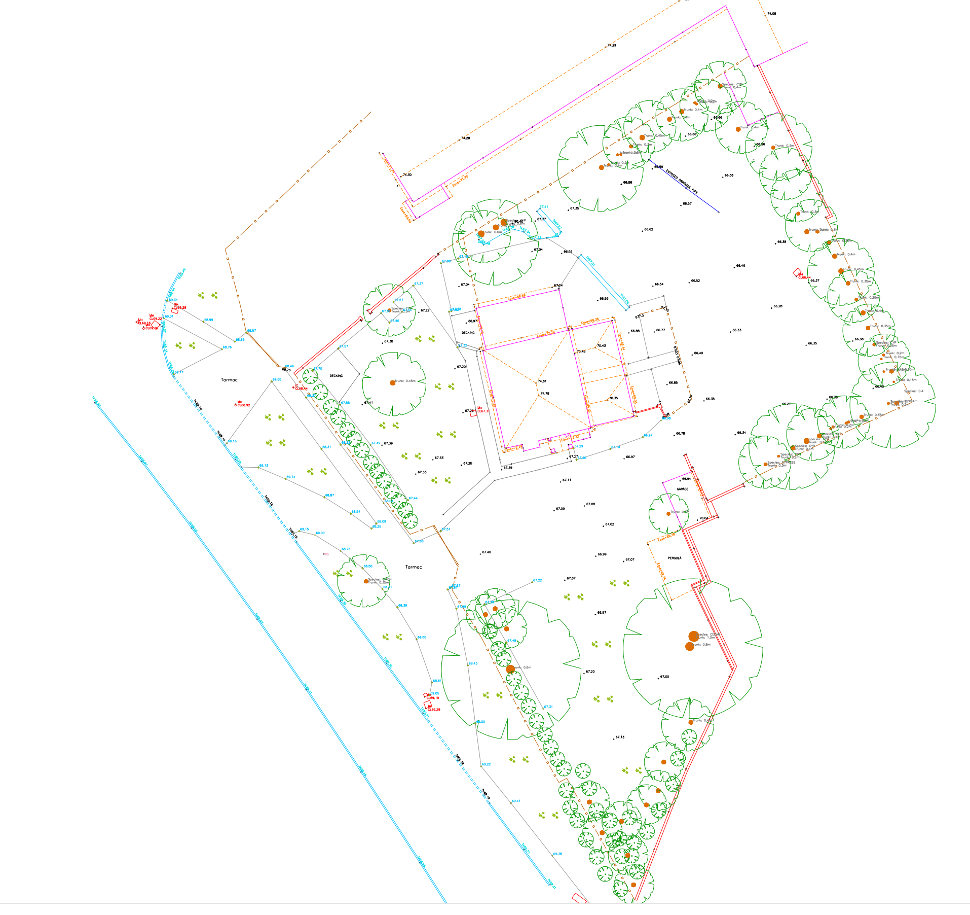
TOPOGRAPHICAL SURVEYS
Mapping an area of land’s physical features, including both natural and of human origin elements, including structures, boundaries, drainage systems, and vegetation is a topographical survey.
In order to accurately reflect the current site, topographical surveys are frequently presented as 2D plans or 3D models. The information gathered can subsequently be applied to a variety of design and development goals, including engineering as well as construction projects. Any project that involves mapping or establishing the boundaries of an area must include a topographic survey.
To ensure thorough, precise, and error-free surveys, ASeel CE LTD only uses the most recent equipment and employs experienced surveyors.
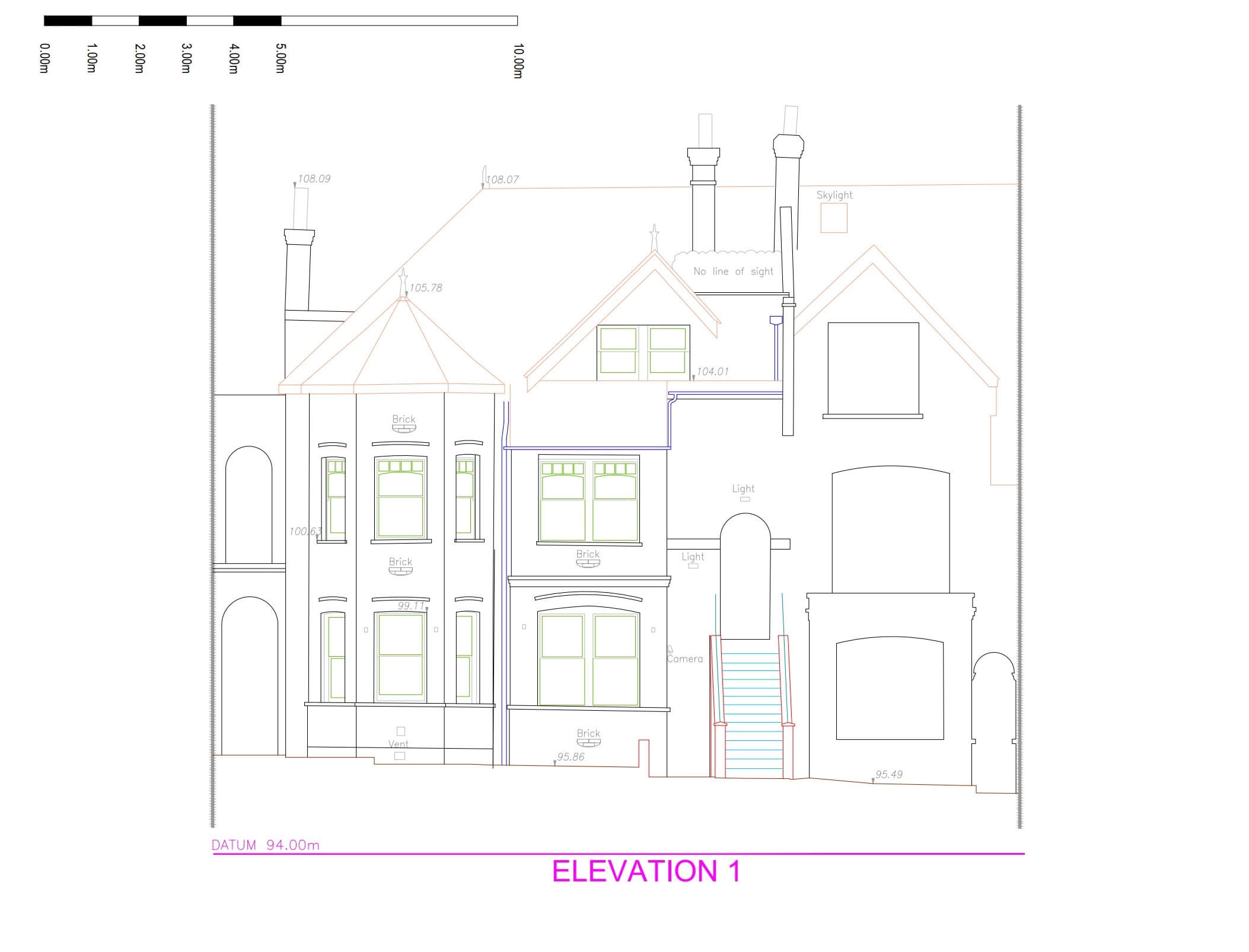
MEASURED BUILDING Survey
Pre-planning is crucial, and it’s frequently requested for refurbishments, conversions, loft or basement extensions. Architects, designers, and developers can plan for renovation or new construction with the use of measured building surveys.
Measured Building Surveys can show whether a development or addition complies with local authority guidelines.
Aseel CE LTD has experience, from little residential surveys to big business projects. By collecting data remotely, laser scanning enables our surveyors to shorten on-site visits, improve accuracy and degree of detail, and lower exposure to hazards.
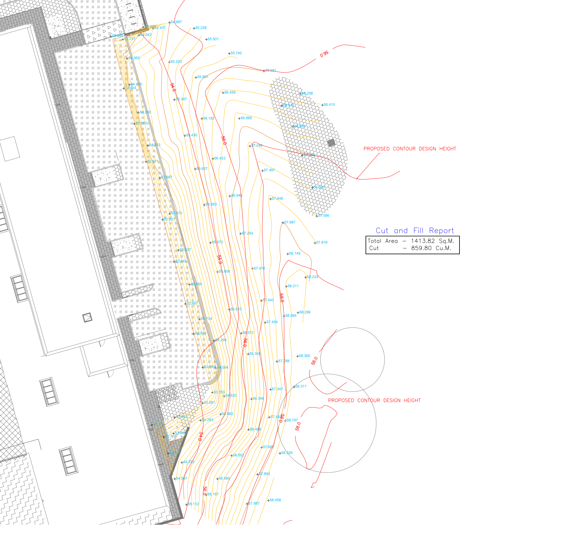
VOLUME & STOCKPILE SURVEYS
One important service we provide to our customers is the measurement of earth stockpiles or cut/fill volumes reports.
Having the ability to price material that needs to be moved off site or to quote for a groundwork or earthwork project appropriately is a key feature for profitable projects. A single load of crushed concrete or muck could be expensive, and counting the wrong volume might result in significant financial loss. By measuring crushed concrete (after demolition) or muck volumes using a Totalstation helps to remove this inaccuracy. Through the use of 3D laser scanning and, more recently, UAVs (drones), surfaces may now be scanned more intensively, lowering the dangers associated with walking across a stockpile’s surface.